National Atlas of Hungary - Antecendents
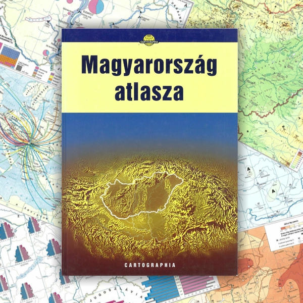
Árpád Papp-Váry (Editor-in-chief) 1999. Atlas of Hungary. Cartographia, Budapest.
This atlas (23.3 x 32.9 cm in size) is much easier to handle than were the former one-volume national atlases. The aim of the publisher was to present, mainly for people involved in higher education, the basic social and economic changes that took place in Hungary after 1989. The atlas has 132 numbered pages, with 106.5 pages of maps and 24.5 pages for an index and a list of settlements. Owing to changes in function and the requirements of the targeted users, the structure of the map pages differed significantly from the 1989 edition of the national atlas. The ratio of map themes became more balanced: the ratio of economic maps fell from 49% to 23%, while the ratio of introductory general geographic and political-administrative maps increased from 10% to 26%. The scale of most maps was 1:2.5 million. The atlas contained 21 maps of the Carpathian Basin (including 16 physical geographical maps), whereas only three maps had shown this broader area in the 1989 edition of the national atlas. This fact clearly reflected a major change in attitude.
Content
Click on the chapters to access the full text!
In accordance with the publisher's request, the full text is available in reduced resolution.
|
|
COVER, TITLE PAGE, COLOPHON, CONTENTS (0.9 MB) | ||
1. |
LEGEND (0.1 MB) | ||
2-3. |
EUROPE, PHYSICAL MAP (0.6 MB) | ||
4-5. |
CARPATHIAN BASIN, PHYSICAL MAP (0.7 MB) | ||
6-7. |
HUNGARY, PHYSICAL MAP (0.6 MB) | ||
8-9. |
HUNGARY, NORTHWEST (0.8 MB) | ||
10-11. |
HUNGARY, SOUTHWEST (0.8 MB) | ||
12-13. |
HUNGARY, NORTHEAST (0.8 MB) | ||
14-15. |
HUNGARY, SOUTHEAST (0.7 MB) | ||
16. |
BUDAPEST AND VICINITY (0.3 MB) | ||
17. |
BUDAPEST AND VICINITY (SPACE IMAGE) (0.3 MB) | ||
18. |
BALATON AND VICINITY (0.3 MB) | ||
19. |
BALATON AND VICINITY (SPACE IMAGE)) (0.3 MB) | ||
| GEOLOGY (1 MB) | |||
20-21. |
Tectonic structure of the Carpathian Basin | ||
22-23. |
Geology of Hungary | ||
| NEOGENE PALEOGEOGRAPHIC MAPS OF THE CARPATHIAN BASIN (0.2 MB) | |||
24. |
Paleogeography of Central and Eastern Europe in the Miocene | ||
| Lower Miocene | |||
| Middle Miocene | |||
| Upper Miocene | |||
| DEVELOPMENT OF DRAINAGE IN HUNGARY (0.2 MB) | |||
25. |
Upper Pliocene | ||
| Lower Pleistocene | |||
| Upper Pleistocene | |||
| Holocene | |||
| GEOMORPHOLOGY (0.6 MB) | |||
26. |
Geomorphological map of the vicinity of Lake Balaton | ||
27. |
Geomorphological map of Budapest (detail) | ||
| Geomorphological map of the Great Plateau (detail of the Bükk Mountains) | |||
28. |
CHARACTERISTIC WEATHER PATTERNS IN EUROPE (0.3 MB) | ||
| CLIMATE OF THE CARPATHIAN BASIN (1.2 MB) | |||
29. |
Average pressure and wind roses in January | ||
| Average pressure and wind roses in July | |||
30. |
Mean January temperature | ||
| Mean July temperature | |||
31. |
Mean annual temperature | ||
| Annual totals of sunshine hours | |||
32. |
Mean precipitation during the winter half–year | ||
| Mean precipitation during the summer half–year | |||
33.
|
Mean annual precipitation | ||
| Average date of flowering of the dandelion | |||
| Average date of flowering of the lilac | |||
| Average date of flowering of the white acacia | |||
| Average date of appearance of winter wheat ears | |||
| HYDROGEOGRAPHY (1.6 MB) | |||
34-35. |
Catchment area of the Danube | ||
36. |
Carpathian Basin before flood control | ||
| Flood and excess water control | |||
37. |
Deep groundwater and karst water resources | ||
| Average groundwater level of the growing season | |||
38. |
Mineral and thermal waters of Hungary | ||
39. |
Changes of the karst water level in the Transdanubian Range | ||
| Thermal waters of the “thermal line of Buda” | |||
| SOILS (0.6 MB) | |||
40. |
Genetic soil map of Hungary | ||
41. |
FAO soil map | ||
| Soil erosion | |||
| FLORA AND FAUNA OF THE CARPATHIAN BASIN (0.6 MB) | |||
42. |
Natural vegetation | ||
43. |
Floristic–phytogeographical division | ||
| Zoogeographical division | |||
44-45. |
TAXONOMIC DISTRIBUTION OF THE NATURAL LANDSCAPES OF HUNGARY (0.6 MB) | ||
46-47. |
NATURE CONSERVATION (0.5 MB) | ||
| STATE OF THE ENVIRONMENT (1 MB) | |||
48. |
Drinking water supply by public utilities, 1997 | ||
| Sewage disposal by public utilities, 1997 | |||
49. |
Quality of surface waters | ||
| Quality of air | |||
50. |
Total emission of major air polluting materials, 1995 | ||
| Major emissions of public traffic, 1995 | |||
51. |
Environmental geology | ||
| Amount of dangerous waste, 1995 | |||
| CHANGES IN THE ADMINISTRATIVE DIVISIONS OF HUNGARY (1.2 MB) | |||
52. |
Administrative divisions, 1914 | ||
| Administrative divisions, 1938 | |||
53. |
Administrative divisions, 1941 | ||
| Administrative divisions, 1950-1989 | |||
54-55. |
Administrative divisions, 1 January1990 – 1 July 1999 | ||
| POPULATION (3.3 MB) | |||
56. |
Density of population, 1784-1787 | ||
| Density of population, 1870 | |||
| Density of population, 1900 | |||
| Density of population, 1949 | |||
| Density of population, 1997 | |||
57.
|
Births, 1997 | ||
| Deaths, 1997 | |||
| Infant mortality, 1997 | |||
| Natural increase, decrease, 1997 | |||
58.
|
Age–sex pyramid of the population, 1960, 1990 | ||
59.
|
Age structure of the population, 1997 | ||
| Age group 0–14 | |||
| Age group 15–39 | |||
| Age group 40–59 | |||
| Age group 60 and over | |||
60.
|
Change in population by individual settlements, 1870-1980 | ||
| Change in population by individual settlements, 1949-1970 | |||
61.
|
Change in population by individual settlements, 1970-1980 | ||
| Change in population by individual settlements, 1980-1990 | |||
62.
|
Density and size of settlements, 1997 | ||
| Distribution of population according to the legal status of settlements, 1997 | |||
63.
|
Ratio of urban population, 1998 | ||
| Ratio of population of outskirts, 1990 | |||
64.
|
Suicides, 1970-1986 | ||
| Migration balance, 1990-1997 | |||
65.
|
Migration balance of towns, 1997 | ||
| Foreign citizens in Hungary, 1996 | |||
66.
|
Ethnic map of the Carpathian Basin | ||
67.
|
Hungarian ethnic regions and groups in the Carpathian Basin | ||
68.
|
Distribution of population according to mother tongue | ||
69.
|
Roma population | ||
| Religions in the Carpathian Basin | |||
| EDUCATION, CULTURE (0.4 MB) | |||
70.
|
Ratio of population not completing primary school, 1990 | ||
| Ratio of graduates of higher education, 1990 | |||
71.
|
Students in higher education institutions, 1997 | ||
| Libraries and book collections, 1997 | |||
| EMPLOYMENT (0.4 MB) | |||
72.
|
Ratio of active population, 1990 | ||
| Breakdown of employees according to economic branches, 1997 | |||
73.
|
Unemployment, June 1993 | ||
| Unemployment, June 1998 | |||
| AGRICULTURE (1 MB) | |||
74.
|
Land use | ||
75.
|
Regional types of plant cultivation | ||
| Regional types of livestock raising | |||
76.
|
Types of plant cultivation, 1984 | ||
| Types of plant cultivation, 1994 | |||
77.
|
Agricultural undertakings, 1997 | ||
| Vine growing and production of wine, 1997 | |||
| Change in cattle-stock, 1986-1997 | |||
| Change in pig-stock, 1986-1997 | |||
| Food industry, production of drinks and tobacco products, 1997 | |||
| POWER INDUSTRY (0.5 MB) | |||
78. |
Coal and hydrocarbon mineral resources and mining | ||
| Network of natural gas, petroleum and petroleum products | |||
79. |
Electricity grid and major power stations | ||
| MINING, INDUSTRY (1.2 MB) | |||
80. |
Coal and hydrocarbon mineral resources and mining | ||
| Regional structure of industry | |||
81. |
Employees in industry, 1990-1997 | ||
| Premises of industry, 1997 | |||
82. |
Material assets of industry, 1997 | ||
| Result of industrial production, 1997 | |||
83. |
Metallurgy, metal industry, 1997 | ||
| Machine industry, 1997 | |||
84. |
Chemical industry, 1997 | ||
| Construction and pottery industry, 1997 | |||
85. |
Wood, paper and printing industry, 1997 | ||
| Textile, clothing and leather industry, 1997 | |||
| TRANSPORT (0.3 MB) | |||
86. |
Railway network, 1998 | ||
| Railway traffic, 1996 | |||
87. |
Road network, 1998 | ||
| Road traffic, 1996 | |||
88. |
Waterways | ||
| Air transport | |||
| TELECOMMUNICATION (0.2 MB) | |||
89. |
Coverage with radio programs, 1998 | ||
| Coverage with television programs, 1998 | |||
| TELECOMMUNICATION, ENERGY CONSUMPTION, FLATS (0.7 MB) | |||
90. |
Telephone coverage, telecommunication mains | ||
| Electric energy consumption, 1997 | |||
91. |
Construction of flats, dwellings, 1990-1997 | ||
| Construction of flats, 1997 | |||
92. |
Households supplied with pipeline gas, 1997 | ||
| Degree of equipment of households, 1990 | |||
| PUBLIC HEALTH (0.2 MB) | |||
93. |
Availability of medical cure, 1997 | ||
| Hospital beds, 1997 | |||
| TOURISM (0.5 MB) | |||
94. |
Tourist attractions | ||
95. |
Tourist regions and districts | ||
| Guest nights | |||
| SETTLEMENT GEOGRAPHY (1 MB) | |||
96. |
Village ground-plan types | ||
97. |
Urban ground-plan types | ||
98. |
Budapest agglomeration | ||
| Changes of Budapest agglomeration | |||
| Migration balance of Budapest agglomeration 1990-1996 | |||
| Ratio of flats in the vicinity of Budapest built by inhabitants of Budapest | |||
99. |
Social structure of Budapest | ||
| Urban zones and types, population change, 1970-1990 | |||
| Density of population, 1990 | |||
| Ratio of higher education graduates, 1990 | |||
| Ratio of single-room dwellings, 1990 | |||
| Ratio of dwellings with three or more rooms, 1990 | |||
| Ratio of dwellings with bath or shower, 1990 | |||
| INVESTMENT, BANKS (0.5 MB) | |||
100. |
Distribution of foreign capital investment by counties, 1997 | ||
| Banks | |||
101. |
Industrial parks | ||
| Zones for enterprises, greenfield investments | |||
102.
|
ACTIVE UNDERTAKINGS, 1997 (0.3 MB) | ||
102.
|
PER CAPITA GROSS DOMESTIC PRODUCT (GDP), 1996 | ||
103. |
PARLIAMENTARY ELECTIONS, 1990, 1994, 1998 (0.3 MB) | ||
| HISTORICAL CHURCHES OF HUNGARY (0.3 MB) | |||
104. |
Catholic dioceses | ||
| Calvinist dioceses | |||
| Lutheran dioceses | |||
| alliance of Hungarian Jewish Faith Communes | |||
| EUROPEAN UNION (0.3 MB) | |||
105 |
European Union | ||
| Regional differences in the European Union | |||
106-107. |
DIPLOMATIC RELATIONS OF HUNGARY (0.5 MB) | ||
108-112. |
SYSTEM OF MICRO-REGIONS (0.8 MB) | ||
113-132.
|
INDEX (5.6 MB) | ||