National Atlas of Hungary - Antecendents
Márton Pécsi (Head of the editorial board) 1989. Magyarország Nemzeti Atlasza – National Atlas of Hungary. Kartográfiai Vállalat, Budapest. (1989)
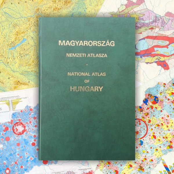
In 1983, the Hungarian Academy of Sciences, under the presidency of János Szentágothai, decided to publish a new edition of the National Atlas of Hungary. As in the case of the 1967 edition, the idea was supported by the government and the Ministry of Agriculture and Food. The atlas was completed in six years under the direction of Márton Pécsi, head of the editorial board and director of the Geographical Research Institute of the Academy. The atlas was prepared in cooperation with 87 (mostly) state institutions and organizations and 183 authors and editors. The atlas was published in 1989, shortly before Hungary 's democratic transformation. It is four times as voluminous as the first edition. The atlas was published in one single volume on 395 pages of 29 x 43 cm. Its bilingual (Hungarian and English) edition was an expression of Hungary's opening to the outside world. The extent of explanatory texts followed international trends and significantly increased compared to the 1967 edition (from 8 pages to 100 pages). Due to the size of Hungary, the scale of most of the maps (1:1 million to 1:2 million) did not change. The structure of topics remained almost the same, reflecting the fact that the primary function of the atlas was to facilitate socialist regional planning. About 60% of the 763 maps continued to show the condition of the national economy, but the ratio of maps dealing with social topics and introductory maps increased slightly (12% and 8% respectively) at the expense of physical geographical maps (21%). When the political climate grew milder in the second half of the 1980s, the acquisition of information became easier. Moreover, it became possible to publish criticism of socialist industrialization, agricultural policy and regional economics. The contents of the atlas reflect such developments.
Book review 1: Márton Pécsi: National Atlas of Hungary. (in Hungarian)
Published in Magyar Tudomány (Hungarian Science) 96/7-8. 545-557. (1989) (PDF, ~3.6 MB)
Book review 2: László Bassa: National Atlas of Hungary. (in Hungarian)
Published in Földrajzi Értesítő (Geographical Bulletin) 38/3-4. 456-458. (1989) (PDF, ~900 KB)
Content
Click on the chapters to access the full text!
| FLYLEAVES, INTRODUCTION, CONTENTS (28.4 MB) | ||
1. |
||
2-3. |
Diplomatic relations 31 December 1986 – Geographical position of Hungary – Budapest: “next living” point – Budapest: “counter living” point – Budapest: antipode |
|
4. |
Hungarians in the world – Hungarians living in neighbouring countries |
|
5. |
Hungary – some international comparisons |
|
6-7. |
Hungary and its neighbourhood |
|
8. |
Satellite image details |
|
9. |
Maps of areas shown on satellite images |
|
10-11. |
Relief and hydrography |
|
12. |
Administrative divisions 1 January 1938 |
|
13. |
Administrative divisions 31 December 1950 |
|
14. |
Administrative divisions 1 January 1980 |
|
15. |
Administrative divisions 1 January 1984 |
|
16. |
Church administration, 1984 – Catholic church – Protestant churches – Hebrew congregations – Eastern orthodox churches – Free churches |
|
17. |
II. SURVEYING AND MAPPING (30.6 MB) | |
18. |
Details of old maps – Lázár deák, 1528 – Zsámoky János, 1571 – Lipszky János, 1806 – 1 : 360 000, 1887 – Mikoviny Sámuel, 1735 – Gönczy Pál, 1885 |
|
19. |
Details of old ordnance maps, aerial maps – 1st military survey, 1764–1785 – 2nd military survey, 1806–1869 – 3rd military survey, 1869–1887 – 1 :75 000, 1930 – Details of aerial photographs |
|
20. |
Cadastral base-map – Map of public utilities – Agrotopographic map |
|
21. |
Parts of sheets of the Uniform National Map System (EOTR) – 1 : 10 000 – 1 : 25 000 – 1 : 100 000 – 1 : 200 000 – Outline map – Outline map (hypsometric) |
|
22. |
Geodetic control networks, 1986 |
|
23. |
State of cadastral survey mapping, 1986 |
|
24. |
Topographic map coverage, 1 January 1988 |
|
25. |
III. RELIEF (27.8 MB) | |
26-27. |
Relief types |
|
28. |
Geomorphological map of the vicinity of Lake Balaton |
|
29. |
Geomorphological map of Budapest (detail) |
|
30-31. |
Geomorphology |
|
32. |
Relative relief |
|
33. |
IV. GEOLOGY AND GEOPHYSICS (58.3 MB) | |
34-35. |
General geological-tectonical map of Hungary and her surroundings |
|
36. |
Subsurface geological map of the pre-Tertiary basement |
|
37. |
Geological sections |
|
38-39. |
Geology |
|
40. |
Paleozoic – Triassic – Jurassic – Cretaceous – Eoecene – Oligocene – Metamorphic rocks – Cainozoic volcanites |
|
41. |
Lower and Middle Miocene – Upper Miocene – Lower Pannonian – Upper Pannonian – Quaternary |
|
42-43. |
Engineering geology |
|
44. |
Coal and hydrocarbon mineral resources |
|
45. |
Ore and non-metallic mineral resources |
|
46-47. |
Hydrogeology |
|
48. |
Vertical intensity anomalies – Total intensity – Vertical intensity – Horizontal intensity – Magnetic declination |
|
49. |
Magnetic inclination – Thickness of the Earth’s crust – Map of geoisotherms at 1000 m depth – Heat flow map – Recent vertical movements |
|
50. |
Geochronology |
|
51. |
V. CLIMATE (35.9 MB) | |
52. |
Characteristic weather patterns – Annual totals of global solar radiation – Annual totals of sunshine hours – Monthly totals of global solar radiation: January – Monthly totals of sunshine hours: January – Monthly totals of global solar radiation: July – Monthly totals of sunshine hours: July |
|
53. |
Mean January temperature – Mean April temperature – Mean July temperature – Mean October temperature |
|
54. |
Mean annual number of days with maximum temperature exceeding 30 °C – Mean annual number of days with maximum temperature exceeding 25 °C – Mean annual number of frost days (min. ≤ 0 °C) – Mean annual number of days with maximum temperature below 0 °C – Mean date of first air frost – Mean day of last air frost – Average duration of frost free period – First day with mean daily temperature above 5 °C in spring – First day with mean daily temperature above 10 °C in spring – First day with mean daily temperature above 12 °C in spring – Mean annual absolute maximum temperature – Mean annual absolute minimum temperature |
|
55. |
Mean January precipitation – Mean February precipitation – Mean March precipitation – Mean April precipitation – Mean May precipitation – Mean June precipitation – Mean July precipitation – Mean August precipitation – Mean September precipitation – Mean October precipitation – Mean November precipitation – Mean December precipitation |
|
56. |
Annual precipitation: Annual number of days with at least 1 mm precipitation – Annual number of days with at least 5 mm precipitation – Annual number of days with at least 10 mm precipitation – Annual number of days with thunder |
|
57. |
Annual number of days with snowfall – Annual number of days with snow cover – Annual number of clear days – Annual number of cloudy days – Annual number of days with maximum wind speed exceeding 15 m/s – Percentage of hours with no wind – Wind roses and mean wind speed in April – Wind roses and mean wind speed in October |
|
58. |
Total winter potential evapotranspiration (October–March) – Total winter actual evapotranspiration (October–March) – Total summer potential evapotranspiration (April–September) – Total summer actual evapotranspiration (April–September) – Accumulated climatic water deficit during the summer half-year (April–September) – Annual climatic water deficit |
|
59. |
Mean air temperature during the cereal growing season III–VI – Mean air temperature during the growing season for root crops IV–IX – Mean rainfall during the cereal growing season III–VI – Mean rainfall during the growing season for root crops IV–IX – Average date of flowering of the dandelion – Average date of flowering of lilac – Average date of flowering of the white acacia – Average date of appearance of winter wheat ears |
|
60. |
Network of meteorological stations |
|
61. |
VI. SURFACE AND GROUNDWATERS (54.5 MB) | |
62-63. |
Hydrogeographic map of the catchment area of the Danube |
|
64. |
Flood and excess water control |
|
65. |
Water balance of the Danube valley for 1985 – Water balance of the Tisza valley for 1985 – The inundated and waterlogged area of the Carpathian Basin before flood control and drainage measures |
|
66-67. |
Drainage |
|
68. |
Minimum groundwater level, 1961–1980 – Maximum groundwater level, 1961–1980 |
|
69. |
Average groundwater level of the growing season, 1969 |
|
70-71. |
Chemical character of groundwater based on data for 1950–1985 |
|
72. |
Total hardness of deep groundwater – Main parameters of quality of deep groundwater (to 600 m depth) |
|
73. |
Iron content of deep groundwater – Total dissolved solids of deep groundwater |
|
74. |
Mineral and thermal waters |
|
75. |
Deep groundwater, karst water and bank filtered water resources, water availability |
|
76. |
Network of hydrological observations |
|
77. |
VII. SOILS (27.9 MB) | |
78-79. |
Soil map |
|
80. |
FAO soil map – Soil erosion |
|
81. |
Clay mineral associations of soils – Land reclamation activity – Location of selected regions for land reclamation – Location of soils to be improved – Land improvement between 1947 and 1985 |
|
82-83. |
Hydrophysical properties of soils |
|
84. |
Main substance regime types of soils – Main moisture regime types of soils |
|
85. |
VIII. BIOGEOGRAPHY, REGIONS OF PHYSICAL FACTORS, LANDSCAPES (25.9 MB) | |
86-87. |
Taxonomic distribution of natural landscape units |
|
88. |
Climatic types – Structural morphology – Soil regions – Climatic zones of vegetation – Floristic-phytogeographical division – Zoogeographical division |
|
89. |
Natural vegetation |
|
90-91. |
Landscape types |
|
92. |
Assessment of physical potentials of microregions for field cultivation – Extinct plant species |
|
93. |
IX. NATURE CONSERVATION AND ENVIRONMENT PROTECTION (31.7 MB) | |
94-95. |
Nature conservation, 1 January 1987 |
|
96. |
Quality of surface waters, 1970 – Quality of surface waters, 1980 |
|
97. |
Exceptional water pollution – Areas of outstanding water quality conservation |
|
98-99. |
Environmental geological conditions, waste contamination |
|
100. |
Air pollution of settlements – Annual average of regional background concentration of atmospheric SO₂, NO₂ (1978–1982) – Annual average of regional wet deposition of atmospheric SO₄, NO₃ (1978–1982) |
|
101. |
Noise emission on the main roads, 1982 – State of environment in the Lake Balaton recreation area |
|
102. |
Environment state of the Budapest agglomeration |
|
103. |
X. POPULATION, SETTLEMENTS, PUBLIC UTILITIES AND DWELLINGS (62 MB) | |
104. |
Change in population by individual settlements – 1870–1980 – 1949–1970 |
|
105. |
1970–1980 – Population by sex, age groups and economic activity (in thousands), 1980 |
|
106-107. |
Regional distribution and density of population, 1980 |
|
108. |
Population age structure, 1980 – Age group 0–14 – Age group 15–39 |
|
109. |
Age group 40–59 – 60 and over age group |
|
110. |
Dates of population maxima by individual settlements, 1870–1980 |
|
111. |
Births, 1970–1979 – Deaths, 1970–1979 – Natural change, 1970–1979 |
|
112. |
Migration balance for individual settlements, 1970–1979 |
|
113. |
Size and type of households, 1980 |
|
114. |
Distribution of the population by nationality, 1980 – Distribution of the population by mother tongue, 1980 |
|
115. |
Gipsy population |
|
116. |
Economic activity of the population, 1980 |
|
117. |
Hungary at the turn of the century |
|
118-119. |
Settlement network, 1986 |
|
120. |
Occupational regroupment structure, 1930–1980 – Demographical types, 1981–1984 |
|
121. |
Daily commuting and labour attraction of towns, 1980 |
|
122-123. |
Occupational structure of the active wage earners in each settlement, 1980 |
|
124. |
Basic institutions in settlements, 1980, 1984 |
|
125. |
Living conditions, 1980 |
|
126-127. |
Town network, 1986 |
|
128. |
Village types, 1980 |
|
129. |
Settlement ground-plan types – Dunaújváros – Hajdúböszörmény – Balatonszárszó – Hortobágy – Jászapáti – Botpalád 18th century – Botpalád – Csemő – Csemő |
|
130-131. |
Population of outskirts, 1980 |
|
132. |
Dynamical types of settlements, 1980 |
|
133. |
Investments in the state and cooperative sectors, 1981–1985 |
|
134. |
Budapest agglomeration – Land use, 1985 – General map, 1985 – Age-sex pyramid (1 January 1980) – Dwelling area per person, 1980 – Ratio of single households, 1980 |
|
135. |
Budapest agglomeration – Population change, 1900–1980 – Date of fall in the ratio of agricultural earners below 30% – Active earners by main economic branches, 1980 – Commuting, 1980 – Concentration of places of employment, 1980 – Isochrone map, 1980 |
|
136. |
Budapest – Development and evolution of Budapest – Population change by districts – Age structure by districts, 1980 – Internal migration, 1985 – Number of population by subdistricts, 1980 – Ratio of persons with intellectual professions by subdistricts, 1960, 1980 – Educational level of population, 1980 – Inter-districts commuting, 1980 – The city (fragment) |
|
137. |
Budapest – Ratio of single-room dwellings by town-planning districts, 1980 – Ratio of dwellings with bath or shower by town-planning districts, 1980 – Population by social classes and strata by subdistricts, 1980 – Dwellings by ownership, 1980 – Functional-morphologic division of the central areas, 1985 |
|
138. |
Finance and insurance, 1987 |
|
139. |
Change of number of flats, 1970–1980 – Number of inhabitants per 100 m2 living space, 1980 |
|
140. |
Average number of rooms per 100 homes and percentage of single-room dwellings, 1980 |
|
141. |
Share of homes supplied with running water, 1980 – Share of rooms complete with sewers, 1980 – Share of rooms complete with bathroom and toilet, 1980 |
|
142. |
Percentage of dwellings built before 1919 – Percentage of dwellings built during 1920–1944 – Percentage of dwellings built during 1945–1969 |
|
143. |
Percentage of dwellings built during 1970–1979 – Per capita communal investments in towns and urban places – Council investments, 1981–1985 |
|
144. |
Ratio of the storied, single residential buildings and private flats in the towns and urban-like settlements, 1980 – Quality of settlements by public utilities and flats, 1980 |
|
145. |
XI. PUBLIC HEALTH (29.6 MB) | |
146-147. |
Primary health care facilities, emergency ambulance service |
|
148. |
Specialized outpatient care facilities, 1983 |
|
149. |
Inpatient care facilities |
|
150. |
Mother, infant and child care facilities |
|
151. |
Public hygiene and epidemiology – Health care responsibilities on regional level – Specialized care responsibilities on regional level – Health manpower – Social welfare facilities |
|
152. |
Health status of the population – Live births, 1985 – Registered patients with non-specific respiratory disease, 1985 – Mortality, 1985 – Mortality due to injury and poisoning, 1985 – Infant mortality, 1985 – Newly registered patients with malignant neoplasms, 1985 – Life expectancy at birth: males, 1984 – Registered patients with nervous diseases and mental disorders, 1985 – Life expectancy at birth: females, 1984 – At-risk pregnancies, 1985 – Mortality due to diseases of the circulatory system, 1985 – Newly registered disabled persons in 1985 |
|
153. |
XII. EDUCATION, CULTURE AND SPORTS (27.8 MB) | |
154. |
Basic education, 1985–1986 |
|
155. |
Secondary education, 1980 – Higher education, 1980 |
|
156. |
Ratio of graduates of primary school, 1980 – Ratio of graduates of secondary school, 1980 |
|
157. |
Ratio of graduates of university and college, 1980 – Qualification level of the population, 1980 |
|
158. |
Theatres, 1985 – Cinemas, 1985 – Number and type of community centres and similar institutions, 1985 – Activities of community centres and similar institutions, 1985 – Museums |
|
159. |
Stock of important libraries, 1983 – Stock of council libraries, 1985 – Intellectual centres of Hungary, 1980 |
|
160. |
Sports establishments, 1986 – Sports establishments supplied per county, 1985 – County data on competition sports, 1985 |
|
161. |
XIII. INDUSTRY AND CONSTRUCTION INDUSTRY (50.2 MB) | |
162-163. |
Distribution of employees by plant size, 1984 |
|
164. |
Breakdown of employees by company workplace, 1985 – Age distribution of employees, 1984 |
|
165. |
Distribution of industrial employees by type of ownership, 1984 – Distribution of industrial employees in agriculture by type of ownership, 1984 – The private sector, 1984 |
|
166-167. |
Distribution of industrial branches by number of employees, 1984 |
|
168. |
Branches of industry by distribution of employees, 1984 – The sectoral structure of industrial activities within agriculture, 1984 – Change in the number of employees in industry (excluding the private sector), 1974–1984 |
|
169. |
Fixed assets: gross and net value, 1984 – Change in gross value of fixed assets, 1974–1984 |
|
170-171. |
Sectoral distribution of fixed assets by gross value, 1984 |
|
172. |
Machines and equipment: gross and net value, 1984 – Change in gross value of machines and equipment, 1974–1984 |
|
173. |
Basic energy sources, 1984 |
|
174. |
Power industry, 1985 |
|
175. |
Distribution of employees in mining, 1985 – Distribution of employees in the electricity industry, 1985 – Electricity generating industry, 1985 |
|
176. |
Electricity grid, 1984 – Trend in peak electricity generation, 1965–1985 – Import and export of electrical energy, 1965–1985 – Use of electricity in different branches, 1985 |
|
177. |
Direct use of energy by energy source, 1985 – Direct use of energy by economic branch, 1985 – Use of thermal energy, 1985 |
|
178. |
Distribution of employees in metallurgy, 1984 – Iron and steel melting, 1984 |
|
179. |
Foundries and forging mills, 1984 – Non-ferrous metallurgy, 1984 |
|
180. |
Distribution of employees in the engineering industry, 1984 |
|
181. |
Heavy engineering equipment, 1984 – Machine tools and industrial robots, 1984 – Agricultural machines, food industry machines and refrigerators, 1984 |
|
182. |
Equipment manufacture for the chemical industry, light industry, environmental protection and miscellaneous categories, 1984 – Manufacture of steel and aluminium structures, 1984 – Metalware industry, 1984 |
|
183. |
Transport equipment industry, 1984 – Electrical engineering and appliance industry, 1984 |
|
184. |
Telecommunications and vacuum engineering technology, 1984 – Precision instruments, 1984 |
|
185. |
Number of employees in building material industry, 1984 – Manufacture of brick, roofing-tile and heat-resisting products, 1984 |
|
186. |
Production of crushed rock, gravel and sand, 1984 – Lime, cement and concrete panels, 1984 |
|
187. |
Pottery and glass industry, 1984 – Number of employees in chemical industry, 1984 |
|
188. |
Structure of production of some chemical enterprises – Petroleum, natural gas and coal processing, air decomposition and dissolved acetylene production, photochemical industry, Fine chemicals production, charcoal production, other chemistry |
|
189. |
Manufacture of plastics and synthetics, 1984 – Pharmaceutical industry and production of nutriments, 1984 – Rubber and paint industry, cosmetics and household chemical industry, forest-chemical industry, 1984 |
|
190. |
Number of employees in light industry, 1984 |
|
191. |
Number of employees in textile and clothing industry, 1984 |
|
192. |
Wood, paper and printing industry, 1984 – Leather, fur and footwear industry, 1984 |
|
193. |
Handicrafts and miscellaneous industry, 1984 – Number of employees in food industry, 1984 |
|
194. |
Gross production value by branches, 1984 – Value added by branches, 1984 – Adjusted gross production value and value added, 1984 |
|
195. |
Efficiency of industry, 1984 – Efficiency of mining, 1984 – Efficiency of electricity, 1984 – Efficiency of metallurgy, 1984 – Efficiency of engineering, 1984 – Efficiency of building material industry, 1984 – Efficiency of chemical industry, 1984 – Efficiency of light industry, 1984 |
|
196. |
The standard of production, 1984 – Construction, 1984 |
|
197. |
XIV. AGRICULTURE AND FOOD INDUSTRY (61.6 MB) | |
198-199. |
Land use |
|
200. |
Agricultural land use map of the Villány Hills (detail) |
|
201. |
Land use – Land use map of Hortobágy, 1880, 1980 |
|
202. |
Land use – Agricultural land use map of the Kiskőrös region, 1770 – 1880 – 1950 – 1965 – Agricultural land use map of area, 1880 – 1980 |
|
203. |
Major changes in agricultural land use, 1950–1980 – Total land area according to user grouping, 31. 05. 1984 – Total land area according to land use, 31. 05. 1984 – Land area of state farms and agricultural complexes according to land use, area of state forestries, 31. 05. 1984 – Collective land area of agricultural co-operatives and that of special co-operatives according to land use, 31. 05. 1984 |
|
204. |
Branches of cultivation, 1984 – Arable lands (fields) – Gardens – Orchards |
|
205. |
Branches of cultivation, 1984 – Vineyards – Meadow and pasture – Forests |
|
206. |
Land use, 1984 – Arable lands (fields) – Gardens – Orchards – Vineyards – Meadow and pasture – Forests – Area taken out of cultivation |
|
207. |
Land assessment, 1982 |
|
208. |
Agricultural water utilization |
|
209. |
Agricultural research and education, 1984 – Plant protection and animal health, 1984 |
|
210. |
Plant cultivation and procurement, 1984 – Wheat – Rye – Rice – Winter barley – Oats – Spring barley – Maize – Peas – Sugar beet – Tobacco – Hemp fibre – Flax fibre |
|
211. |
Plant cultivation and procurement, 1984 – Sunflower – Rape seed – Oil flax – Soybean – Poppy seed – Maize for silage – Alfalfa – Purple medick – Potatoes – Cabbage – Savoy – Kohlrabi |
|
212. |
Plant cultivation and procurement, 1984 – Cauliflowers – Carrots – Parsley – Onions – French beans – Green peas – Tomatoes – Cucumbers – Paprika spice – Green peppers – Water-melons – Strawberries |
|
213. |
Plant cultivation and procurement of fruit for sale, 1984 – Total production and procurement of food – Apples – Pears – Cherries – Morelloes – Plums – Apricots – Peaches – Raspberries – Nuts – Berry fruit – Total fruit production |
|
214. |
Livestock, 1984 – Cattle – Pigs – Horses – Sheep – Fowl – Turkeys – Geese – Ducks |
|
215. |
Sale, 1984 – Sale of cattle and pigs for slaughter – Sale of sheep and horses for slaughter – Sale of chickens for slaughter – Sale of sheep and cow’s milk – Sale of eggs – Sale of wool and honey – Sale of agricultural products |
|
216. |
Boundaries and centres of large-scale agricultural farms |
|
217. |
Large-scale agricultural farms – Consumption of fertilizers – 1984 –Total power of tractors, 1984 |
|
218. |
Large-scale agricultural farms, 1984 – Gross value of fixed assets I. – Gross value of fixed assets II. |
|
219. |
Large-scale agricultural farms, 1984 – Net value of fixed assets I. – Net value of fixed assets II. |
|
220. |
Number of employees in the large-scale farms |
|
221. |
Distribution of large-scale farm employees by age and sex, 1980, 1985 – Qualification of manual workers employed in large-scale farms, 1980, 1985 – Average earnings of employees in the large-scale farms |
|
222. |
Large-scale agricultural farms – Wheat |
|
223. |
Large-scale agricultural farms – Maize |
|
224. |
Large-scale agricultural farms – Sunflower |
|
225. |
Large-scale agricultural farms – Sugar beet – Potatoes |
|
226. |
Large-scale agricultural farms – Green peppers (Capsicum – Red peppers (Seasoning paprika) – Tomatoes |
|
227. |
Large-scale agricultural farms – Onions – Green peas – Cabbage |
|
228. |
Large-scale agricultural farms – Vine-growing – Characteristic structure of species on large-scale vine plantations, 1985 |
|
229. |
Wine districts |
|
230. |
Large-scale agricultural farms – Apples – Plums |
|
231. |
Large-scale agricultural farms – Apricots – Peaches |
|
232. |
Large-scale agricultural farms – Lucerne – Red clover |
|
233. |
Large-scale agricultural farms – Maize for silage – Green maize |
|
234. |
Large-scale agricultural farms – Cattle |
|
235. |
Large-scale agricultural farms – Pigs raised on large-scale farms – Pigs raised on small-scale farms |
|
236. |
Large-scale agricultural farms – Horses – Sheep |
|
237. |
Proportion of basic activity, 1984 |
|
238-239. |
The structure of gross production value in large-scale, 1984 |
|
240. |
Large-scale agricultural farms – Share of industry out of all activities – Share of food processing out of manufacture, 1984 |
|
241. |
Large-scale agricultural farms – Food processing activity of large-scale farms, 1984 |
|
242-243. |
Large-scale agricultural farms – Industrial activity of large-scale farms 1984 |
|
244. |
Large-scale agricultural farms – Production per 100 forints of resource value – In all forms of activity – In the basic activity – In crop cultivation – In livestock raising – In the supplementary activities – Achieved outside the basic activity |
|
245. |
Averages for efficiency and replacement of fixed assets for 1982–1984 by natural region – Results per net fixed asset value in the collective farms – Results per net fixed asset value in the collective and state farms – Per capita results in the collective farms – Per capita results in the collective and state farms – Net value of fixed assets per capita in the collective farms – Net value of fixed assets per capita in the collective and state farms – Degree of equipment with, and efficiency of, fixed assets in the collective farms – Degree of equipment with, and efficiency of, fixed assets in the collective and state farms – Results per hectare intensive area in the collective farms – Results per hectare intensive area in the collective and state farms – Available net development resources as a percentage of depreciation in the collective farms – Available net development resources as a percentage of depreciation in the collective and state farms |
|
246. |
Deviation of profitability from the average of main-branch activities in collective and state farms in the natural regions, average for the years 1976–1981 – Result per 100 Ft equipment in crop cultivation – Result per 100 Ft equipment in livestock raising – Result per 100 Ft equipment in the supplementary activities – Result per 100 Ft equipment achieved outside the basic activity – Result per workday in crop production – Result per workday in livestock raising – Result per workday in the supplementary activities – Result per workday achieved outside the basic activity – Result per 100 Ft outlay in crop cultivation – Result per 100 Ft outlay in livestock raising – Result per 100 Ft outlay in the supplementary activities – Result per 100 Ft outlay achieved outside the basic activity |
|
247. |
Large-scale agricultural farms – The regional differentiation of replacement of fixed assets based on internal resources in agricultural co-operatives and state farms (collective agricultural units) |
|
248. |
Sylviculture, 1985 |
|
249. |
Game management and hunting, 1984 |
|
250-251. |
Distribution of forests by tree types and ages |
|
252. |
Milling industry, 1984 – Baking and farinaceous foodstuffs industry, 1984 |
|
253. |
Vegetable oil industry, tobacco industry, 1984 – Sugar industry, confectionery, 1984 |
|
254. |
Preserving industry, 1984 – Meat, poultry and egg processing industry, 1984 |
|
255. |
Dairy industry, 1984 – Production of mineral, soda water and soft drinks, manufacture of spirits and starch, 1984 |
|
256. |
Wine industry, 1984 – Brewing industry, 1984 |
|
257. |
XV. TRANSPORT, POST AND TELECOMMUNICATION (33.9 MB) | |
258-259. |
Transportation network, 1986 |
|
260. |
Rail freight traffic, 1984 – Rail passenger traffic, 1984 |
|
261. |
Traffic volume on public roads, 1985 – Accessibility of county seats, 1985 |
|
262. |
Freight traffic through the river ports and out-track platforms, 1983 – Important indexes of shipping – Passenger traffic of the ports of Lake Balaton, 1983 |
|
263. |
Air transport – Budapest-Ferihegy Airport |
|
264. |
Postal telephone network and coverage, 1985 – Telex network and coverage, 1985 – System for forwarding postal traffic, 1985 |
|
265. |
Newspaper distribution, 1983 – Postal letter and parcel traffic, 1970–1983 – Coverage with radio programs, 1984 – Coverage with television programs, 1984 |
|
266. |
Public transport in Budapest inner area, 1987 |
|
267. |
XVI. INTERNAL TRADE, CATERING AND SERVICES (27.2 MB) | |
268. |
Retail trades network, 1985 |
|
269. |
Per capita retail sales (total), 1985 – Retail sales related to national average, 1985 |
|
270. |
Per capita sales of industrial goods, 1985 – Per capita sales of food and stimulants, 1985 |
|
271. |
Role of towns in retail sales, 1985 – Intensity of sales of industrial goods in towns and its distribution by main articles, 1985 |
|
272. |
Intensity of catering trade, 1985 |
|
273. |
Catering trade per capita, 1985 – Number of workers in socialist service industries, 1985 –Employees in small industry, 1985 – Value of services per inhabitant, 1985 – Distribution of services by sector, 1985 |
|
274. |
Consumer services for public institutions, 1985 – Consumer services for households, 1985 |
|
275. |
XVII. TOURISM (37.5 MB) | |
276. |
Tourist attractions, 1984 |
|
277. |
Organisation of tourism and touristic mobility of population, 1984 |
|
278-279. |
Monuments, 1986 |
|
280. |
Capacity of public accommodation establishments, 1984 |
|
281. |
Tourist accommodation, 1984 |
|
282. |
Commercial tourist accommodation, 1984 |
|
283. |
Frequency of visits to tourist regions and tourist turnover at frontier crossings, 1984 |
|
284. |
Features of tourist regions with high priority, 1984 |
|
285. |
XVIII. FOREIGN TRADE (14 MB) | |
286-287. |
Foreign trade, 1984 |
|
288. |
Hungarian foreign trade turnover in international comparison |
|
289. |
XIX. REGIONAL PLANNING (12.4 MB) | |
290. |
Regional physical plan for the Budapest agglomeration, 1985 |
|
291. |
Land-use plan for the Lake Balaton recreation area, 1985 |
|
292. |
Urban physical plan for Debrecen – Communal physical plan for Őriszentpéter |
|
293. |
EXPLANATORY NOTES TO THE NATIONAL ATLAS OF HUNGARY (55.3 MB) | |